Population
| 2020 Census |
8,629 |
| 2010 Census |
8,702 |
| 2000 Census |
8,777 |
| 1990 Census |
7,826 |
| 1980 Census |
7,275 |
| 1970 Census |
7,393 |
| 1960 Census |
5,537 |
| 1950 Census |
3,429 |
| 1940 Census |
2,664 |
| 1930 Census |
2,149 |
| 1920 Census * |
2,373 |
| 1880 Census * |
1,625 |
2000 Census Categories |
| White |
8141 |
| Black or African/American |
34 |
| American Indian |
15 |
| Asian |
420 |
| Other/Mixed |
167 |
| Hispanic/Latino |
303 |
| Over 65 |
1109 |
| 18-64 |
5361 |
| Under 18 |
2307 |
Voters
| Over 18 - 2000 Census |
6470 |
| Registered Voters (6/03) |
5627 (87%) |
Voters registered
as "Unaffiliated" |
3235 (58%) |
Property Value
| 1881 * |
:$ 764,000 |
| 1998 Equalized |
$ 882,000,000 |
| 1999 Equalized |
$ 941,000,000 |
| 2000 Equalized |
$ 1,026,000,000 |
| 2001 Reassessment |
$ 1,248,000,000 |
| The Ratable Total for 2016 was $1,610,953,700 |
| The Ratable Total for 2017 was $1,628,825,200 |
* 1880/81 and 1920 figures include Harding Twp.
| Residential |
There are 2,901 residential properties
There are 27 farm assessed parcels
There are 157 commercial properties |
The average residential value is $498,600 |
94% of the residential properties (86% of the housing units) are Owner-Occupied.
88% of the housing units are served by the public sanitary sewer system. |
|
Residential Property Values
- About 16% of single-family residences are assessed at over $500,000.
- Our average residence is assessed at $379,000.
- The median (half above, half below) residence is assessed at $350,000.
12.13 square miles. 55% of the Township consists of vacant land, parks, conservation and open space areas, due principally to the existence of wetlands, flood plains and steep slopes. 47% of the township is public parkland.
The highest elevation in Long Hill Township is 449 feet above sea level (northeast of the intersection of Long Hill Rd. and Gillette Rd.).
Long Hill Township is bordered for 12.4 miles by the Passaic River. This is approximately 15% of the entire length of the river.
|
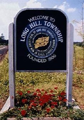 Long Hill Township was incorporated as Passaic Township in 1866. In November, 1992 the voters elected to change the name of the municipality to Long Hill. Long Hill was named one of 25 Great Towns by New Jersey Magazine in March, 1999.