From Morristown, Northern NJ, Hudson Valley |
Google Map with Directions
NY Thruway:
- at Suffern (exit 15) take I-287 South
Bergen/Passaic County, George Washington Bridge:
- Take I-80 West to exit 43, then I-287 South
Sussex/Warren County, Delaware Water Gap:
- Take I-80 East to exit 43, then I-287 South
On I-287 South, pass Morristown, then 6 more miles to exit 30A. You will be on North Maple Ave.
- 1.6 miles to Basking Ridge center. Gentle left onto South Maple Ave. 2.6 miles to blinker light. This is Long Hill Road.
- Gentle right for Millington or gentle left for Stirling, Gillette and Meyersville. Follow the signs.
LIBRARY (until 2005) - Gentle left onto Long Hill Road. 1.0 mile to stop sign. Right on Central Avenue. 0.2 miles on the left (opposite Central school).
POLICE - Gentle left onto Long Hill Road. 1.0 mile to stop sign. Right on Central Avenue. 0.8 miles to Mercer Street. (Last side street BEFORE the traffic light.) Turn left. Last building on the left.
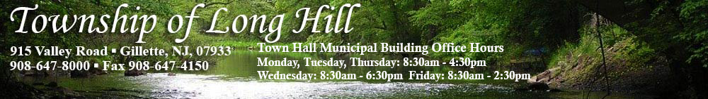
TOWN HALL, LIBRARY, RIVERSIDE PARK - Gentle left onto Long Hill Road. 1.0 mile to stop sign. Right on Central Avenue. 0.9 miles to traffic light. Left on Valley Road. 0.9 miles on the right.
|
|
|
From Central and Western NJ, Eastern Pennsylvania |
Trenton, Princeton, Flemington, Somerville:
- Get to US-206 North or US-202 North to I-287 North.
- Then 3.5 miles to I-78 East.
- Phillipsburg: Take I-78 East past I-287.
- I-78 East 6.5 miles from I-287 to Exit 36.
- Left on King George Rd. 1.2 miles to white church. Right on Valley Rd. (County Rte. 512). 0.6 mi to Division Ave. (County Rte. 605)
- Turn left for Millington and Meyersville or continue straight for Stirling and Gillette.
LIBRARY (until 2005) - Continue on Valley Rd. another 1.4 miles to first traffic light. Left onto Main Avenue. 0.7 miles on the right (opposite school).
POLICE - Continue on Valley Rd. another 1.4 miles to first traffic light. Left onto Main Avenue. First right onto Mercer Street. Last building on the left.
TOWN HALL, LIBRARY, RIVERSIDE PARK - Continue on Valley Rd. another 2.4 miles. On the right.
|
|
From Newark, NYC Tunnels, Turnpike, Garden State Parkway |
- Turnpike to Exit 14 (Newark Airport) or Garden State Parkway to Exit 142 and get on I-78 West.
- There is no ramp from the Garden State Parkway NORTHBOUND to I-78 WESTBOUND.
- You will go EAST on I-78 one exit, then make a U-turn.
- Follow the signs.
- Drive West on I-78 to Exit 40.
- Right on Hillcrest Rd. 1 mile to Stop sign. Straight through (slight left), then 0.7 miles to traffic light. This is Gillette.
- Turn left for Stirling and Millington or straight through for Meyersville.
LIBRARY (until 2005) - Turn left onto Valley Rd. 1.5 miles to the third traffic light. Right onto Main Avenue. 0.7 miles on the right (opposite school).
POLICE - Turn left onto Valley Rd. 1.5 miles to the third traffic light. Right onto Main Avenue. First right onto Mercer Street. Last building on the left.
TOWN HALL, LIBRARY, MATTHEW G. KANTOR MEMORIAL PARK (Formerly Riverside Park) - Turn left onto Valley Rd. 0.6 miles on the left.
|
|
From nearby towns to the Riverside Recreation Park |
From the east via Route 22
- US-22 west 1.9 miles past Sears to Watchung Avenue, Plainfield. (Sign says "Veterans Hospital".)
- Sudden right turn onto Watchung Avenue.
- 1.1 miles to Watchung traffic circle. Second exit is Stirling Road. Sign says "Stirling"
- 3.3 miles to the end. Turn right onto Valley Road.
- 0.3 miles. Recreation fields are on the right. Park behind Town Hall.
|
From Union County towns
- West on Springfield Avenue through Summit, New Providence and Berkeley Heights.
- Enter Long Hill on a high bridge over the Passaic River. Street name changes to Valley Road.
- 1.5 miles. (Second traffic light.) Recreation fields are on the left. Park behind Town Hall (under construction).
|
From Essex County towns
- JFK Parkway south to Short Hills Mall .
- Continue on JFK Pkwy and stay left for "River Road - Summit". Cross under Route 24.
- 0.9 miles to the first traffic light. "Novartis" on your left. Straight through.
- 0.1 miles to a traffic triangle. Left turn onto Passaic Avenue (sign says "New Providence").
- 1.2 miles to Springfield Avenue (county route 512). Turn right.
- 4.5 miles west on Springfield Avenue through New Providence and Berkeley Heights.
- Enter Long Hill on a high bridge over the Passaic River. Street name changes to Valley Road.
- 1.5 miles. (Second traffic light.) Recreation fields are on the left. Park behind Town Hall (under construction).
|
From Basking Ridge
- Get onto South Maple Ave (sign says Millington).
- 2.6 miles to blinker light. Gentle left onto Long Hill Road.
- 1.0 mile to stop sign. Right on Central Avenue.
- 0.9 miles to first traffic light. Left on Valley Road
- 0.9 miles. Recreation fields are on the right. Park behind Town Hall.
|
From Lyons Mall
- South on Stonehouse Road toward the quarry.
- 1.9 miles to King George Road (Millington Baptist Church). Turn left on Valley Road (county road 512).
- 3.0 miles. Recreation fields are on the right. Park behind Town Hall.
|
From Liberty Corner
- Mt. Airy Road or Martinsville Road south to Valley Road (county route 512). Turn left onto Valley Road.
- 2.6 miles (stay on 512) to King George Road (Millington Baptist Church). Turn left on Valley Road (still county route 512).
- 3.0 miles. Recreation fields are on the right. Park behind Town Hall.
|